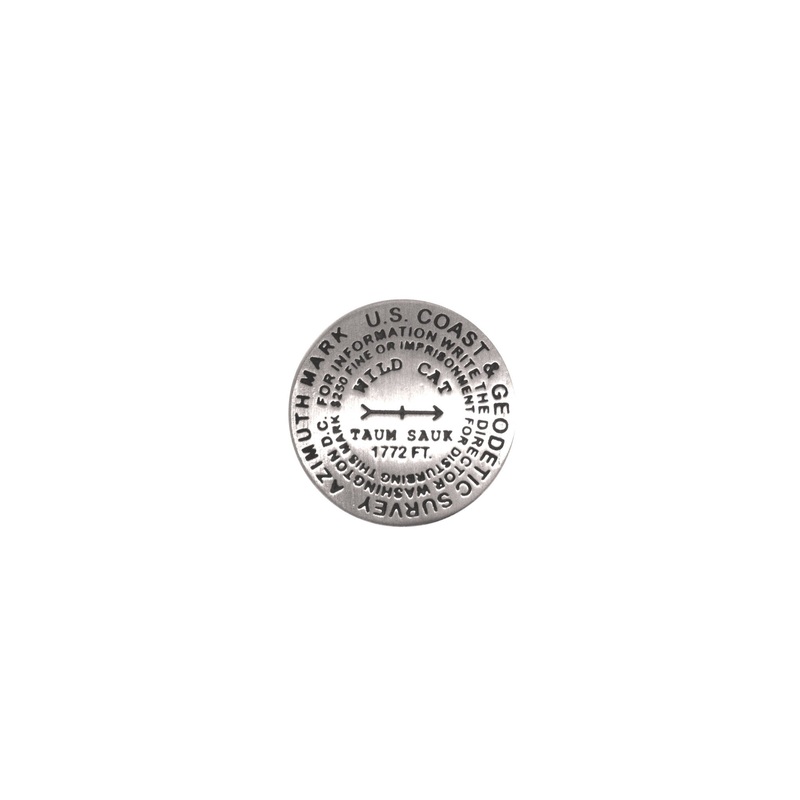
Taum Sauk Pin
1 inch diameterCast in fine pewterMilitary clutch backMounted on story cardPlace Name: Taum Sauk MountainElevation: 1772 ft.Coordinates: N37 34' 13'' W90 43' 40'' Location: Saint Francois Range, Missouri, USA MarkerSleuth Photo Contributors: Jack LongacreT
- 1 inch diameter
- Cast in fine pewter
- Military clutch back
- Mounted on story card
Place Name: Taum Sauk Mountain
Elevation: 1772 ft.
Coordinates: N37 34′ 13” W90 43′ 40”
Location: Saint Francois Range, Missouri, USA
MarkerSleuth Photo Contributors: Jack Longacre
Taum Sauk Mountain is a popular state high point and an easy check off for members of the Highpointers Club. The Mina Sauk Falls Trail is handicap accessible to the broad summit. The trail continues a three mile loop to Missouris other geologic wonder, the Mina Sauk Falls, the states highest, and most spectacular, waterfall.

Reviews
There are no reviews yet.