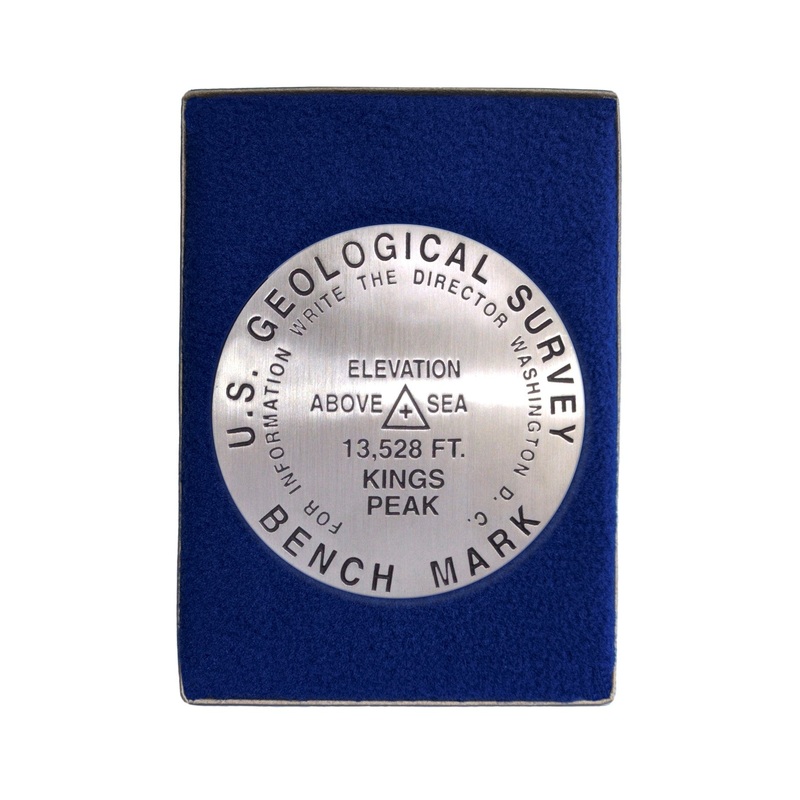
Kings Peak Paperweight
3 1/4 inch diameterCast in fine pewterButton Felt backingIn a fitted fleece interior of a clear-acrylic covered gift box.Place Name: Kings Peak Elevation: 13,528 ft.Coordinates: N44 46' 43'' W110 22' 28'' Location: Unita Range, Utah, USA MarkerSleuth Photo
- 3 1/4 inch diameter
- Cast in fine pewter
- Button Felt backing
- In a fitted fleece interior of a clear-acrylic covered gift box.
Place Name: Kings Peak
Elevation: 13,528 ft.
Coordinates: N44 46′ 43” W110 22′ 28”
Location: Unita Range, Utah, USA
MarkerSleuth Photo Contributor: No Station Found
Kings Peak, Utah’s state highpoint, is situated in the High Unitas Wilderness Area. The Unita Range of the Rocky Mountains is unique because of running east to west. Summitting Kings Peak is a long hike. Because the round trip is about 24 miles, most hikers camp overnight on the mountain and complete the climb in two days. July and August are the most popular months for climbing. Those wishing for a little less traffic should consider climbing in June or September.

Reviews
There are no reviews yet.